
Reporting a map issue
CityWalker's streets come from OpenStreetMap, a map built by volunteers. Occasionally a path is missing, the wrong type, drawn in the wrong place, or one you can't actually walk. If you spot something wrong while looking at the map, you can tell me in a few taps.
If the question is about which paths CityWalker includes rather than a map error, see what counts as a walkable street.
How to report an issue
-
1Open the map. Either the walk detail map or a city's coverage map.
-
2Long-press the spot on the map where the problem is. For a street you can't walk, long-press the street itself.
-
3Choose Report a map issue, then what kind of problem it is: Not walkable or Other issue.
A street you can't walk: Not walkable
Now and then the map shows a path you can't actually walk: it crosses someone's garden, sits behind a locked gate, is for cars only, or no longer exists. Those streets still count toward your city's total, so your coverage can never reach 100%. Mark them Not walkable: the street leaves your coverage straight away, and if I confirm it, it comes off the map for everyone walking that city.
-
1Choose Not walkable. The street it found is highlighted on the map and named on the card, so check it's the right one. If the street is split into parts, tick Include the rest of this street to report all of it.
-
2If you like, add a short reason, for example "private garden, gate at both ends". It helps me review it faster.
-
3Leave Hide this street from coverage while it's reviewed on, and tap Send Report.
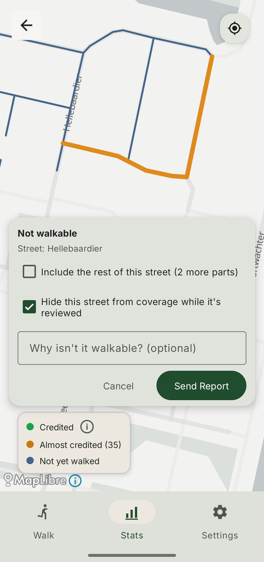
The street turns grey and dotted on your coverage map and stops counting toward your total. If you're offline, the report is saved and sent once you're back online.
What happens after you report it
- I review every report. I check the map, the street's details on OpenStreetMap and your reason.
- If I confirm it, the street is taken off your phone without downloading the city again, and new downloads of that city leave it out. Other people who already have that city see a card on their Stats screen and can remove it with one tap.
- If I don't, the app tells you the report is closed and the street counts again. You can still choose Keep hidden to leave it out of your own coverage.
- Someone else got there first? Once I've had a first look at a report, other people walking that city see it on their Stats screen. Tap View to find the street on the map, then Agree to add to the report and hide the street while it's reviewed.
What gets sent
A Not walkable report goes to CityWalker's server, not by email. It holds the street's OpenStreetMap IDs, the point you long-pressed and the reason you typed, if any. It isn't linked to you or your device, and it never includes your walks or your location history. While a report is under review, and after I confirm it, other people walking that city can see the reported street, but not your reason. See the privacy policy for the details.
Anything else: Other issue
A missing path, a street drawn in the wrong place, a wrong street type, or anything else that's off.
-
1Choose Other issue and describe what's wrong, for example a missing path or a wrong segment.
-
2Tap Send Report. Your email app opens with the details already filled in.
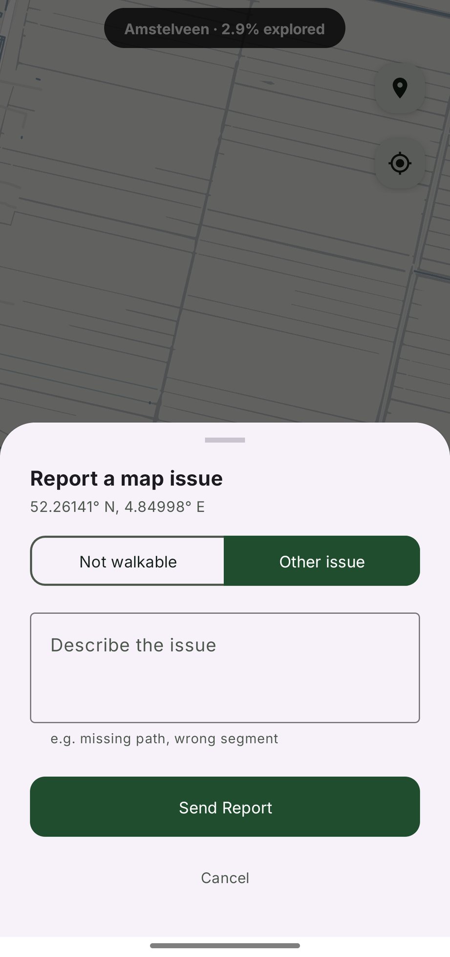
What gets sent
An Other issue report is just a plain email, prepared for you and sent through your own email app. Nothing is sent automatically or in the background. The pre-filled message includes:
- The coordinates of the spot you long-pressed.
- The city the location belongs to.
- A link to OpenStreetMap centred on that spot, so the issue is easy to locate.
- Your description of the problem.
That's all. No personal data, no walk history, no other context is included unless you add it yourself.
What happens next
Reports go straight to me. I read every one. Some are easily fixed in the app, some help me spot a pattern, and some are a problem in the OpenStreetMap data that needs fixing there, so the fix benefits everyone walking that area, not just you. I will usually reply to let you know what I found.
If no email app is set up on your phone, CityWalker will let you know instead of sending. You can still reach me any time at [email protected].
Then fix it on OpenStreetMap
A report fixes the problem for CityWalker. Fixing it on OpenStreetMap fixes it at the source: every map, navigation and fitness app built on OpenStreetMap gets it right, so nobody else is sent down a path they can't use, or misses one that's there. It only takes a few minutes, and it's the best way to make sure the street stays fixed.
Not sure? Leave a note
On openstreetmap.org, zoom in to the spot and use Add a note to the map. Describe what you saw, for example "Path runs through a private garden, signed Private at the gate." You don't need an account. Local mappers check notes and update the map.
Sure, and know the spot? Edit it
- Create a free account on openstreetmap.org and log in.
- Zoom in to the spot and click Edit. The editor opens with a short walkthrough the first time, which is worth doing.
- Make the change:
- A path you can't walk: click it, and in the tag list add
access=privateif it's private, orfoot=noif walking is forbidden but other access is allowed. - A path in the wrong place: drag its points to where it really runs.
- A missing path: use Line to draw it, and choose what kind of path it is.
- A path you can't walk: click it, and in the tag list add
- Click Save and describe your change, for example "Marked path private, signed at the gate".
If you like, add #CityWalker to the end of your comment. It
lets me see which streets get fixed, and lets mappers see where an edit
came from.
New to editing? OpenStreetMap's own beginners' guide and LearnOSM explain the basics.